
Description
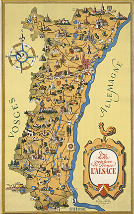
Illustrated Map of Alsace, France
A richly detailed pictorial map of Alsace, highlighting towns, regional industries, and historic landmarks—complete with coats of arms and decorative motifs along the Rhine corridor.
Details:
• Artists: Willy Fischer, Milo Kuntz
• Region: Alsace, France
• Medium: Original lithograph
• Backing: Linen backed
Condition:
Very good condition; clean and well preserved.
Dimensions & Framing:
Linen backed; ready to frame.
Provenance & Background:
A classic regional promotional map emphasizing Alsace’s identity between France, Germany, and Switzerland.
Authenticity:
Original lithograph with COA.
Purchase & Shipping:
Ships worldwide.






Reviews
There are no reviews yet.