


Description
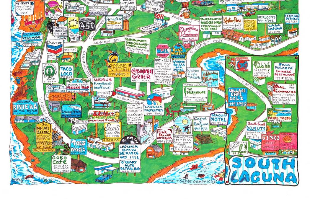
Laguna Beach California illustrated tourist map poster 1998 Home Towne Graphics lithograph
This 1998 illustrated map of Laguna Beach approaches place-making through detail and personality rather than distance or scale. Packed with hand-drawn buildings, local businesses, winding roads, and labeled landmarks, the composition reads less like a navigational tool and more like a visual inventory of a coastal town at a specific moment in time.
The Pacific Coast Highway threads through the image as a central spine, while side streets branch outward into neighborhoods rendered with an almost storybook density. Each stop—restaurants, shops, cultural venues—appears individually named and situated, creating a layered snapshot of everyday life rather than an idealized destination view. The coastline and hills are stylized in bright, saturated color, reinforcing the sense of place without sacrificing clarity.
What distinguishes this piece is its documentary quality disguised as play. Many of the businesses captured here have since disappeared or changed, giving the map an unintentional archival value. It preserves not just geography, but a commercial and cultural ecosystem as it existed in the late 1990s.
A lively and information-rich example of illustrated cartography, appealing both as wall art and as a time capsule of Laguna Beach before the turn of the century.


Reviews
There are no reviews yet.